
3D flight tracker
3D flight tracker: live planes on a 3D globe
A 3D flight tracker shows live aircraft at their real height over terrain and cities. Right now 4,702 aircraft are broadcasting in the air, as of .
Unlock the 3D globe: Black Clearance $9.99/mo
The full 3D globe comes with Black Clearance. Everyone gets the live 2D flight map free, plus a free 60-second 3D preview when one is available.
Right now in the sky
- In the air now
- 4,702
- Over the US
- 1,862
- On the ground
- 0
- Military, broadcasting
- 64
By altitude
Busiest US states
Elsewhere
Aircraft in the air, by the state, country or sea under them (to the nearest half degree). Airports: see live airport pages.
What you can do in 3D
- Photorealistic 3D cities you can fly through
- Follow an aircraft and watch its trail climb and descend
- Cockpit ride-along from the pilot seat
- A live 3D landing view at the runway
- Terrain and mountains under every flight
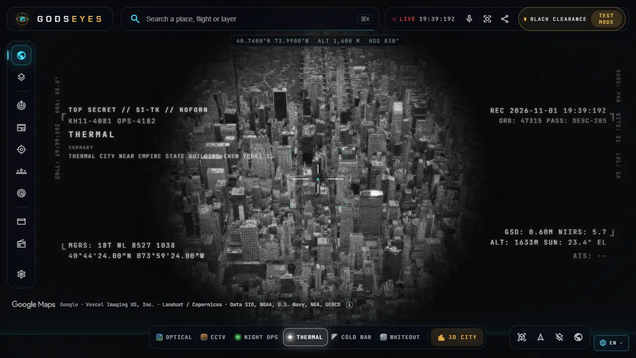
- Vision modes: Night Ops, Thermal, CCTV and more
- Ships, satellites, weather and quakes on the same globe
All of these happen on the 3D globe. Paid features named here: 3D globe, Photorealistic 3D cities, Cockpit ride-along, Live 3D landing view. The vision modes also work on the free 2D map.
Try it on the live map
Free on the live map
With Black Clearance
- The full 3D globe, with photorealistic cities to fly through: start over New York
- Ride along from the pilot's seat
Black Clearance is $9.99 a month or $79 a year. Compare plans
Is there a free 3D flight tracker?
Yes, several small sites show flights on a 3D globe for free. On Gods Eyes, everyone gets the live 2D flight map free, and a 60-second 3D preview when one is available. The full 3D globe, with photorealistic cities and the cockpit view, comes with Black Clearance at $9.99 a month or $79 a year, and it puts ships, satellites and weather in the same view.
How is a 3D flight tracker different from a flight map?
A flat map shows where a plane is. A 3D view also shows how high it is against terrain and buildings, so climbs, descents, holding patterns and approaches into an airport are easy to read. You can tilt the view, follow an aircraft or ride along from the cockpit. The data is the same; the picture is easier to understand.
Can I see planes in 3D over my city?
Yes, if aircraft over your area broadcast ADS-B and a receiver nearby shares the data. Open the map, go to your city and tilt the view; here is New York. For a quick text answer without the map, what's flying over me lists the nearest aircraft, how high they are and which way to look, and planes over New York shows a city page.
Where does the flight data come from?
Aircraft with ADS-B broadcast their position, altitude, speed and callsign about once a second. Volunteer receivers pick these signals up and share them through networks such as ADSBHub and adsb.lol, and we draw them on the globe. Positions from ADS-B receivers via ADSBHub and adsb.lol (ODbL 1.0). The map refreshes positions about every 30 seconds, and coverage depends on nearby receivers.
How accurate are altitude and position?
ADS-B positions come from the aircraft's own GPS, so they are usually accurate to a few meters. Altitude is pressure altitude, which can differ from height above the ground by a few hundred feet, especially near mountains. A position can lag by up to about a minute between refreshes, so don't use it for anything safety-related.
Which aircraft don't show up?
Aircraft without ADS-B, aircraft out of range of any receiver (over oceans or remote land), and aircraft whose owners opted out through the FAA's LADD or PIA programmes. Military aircraft are not on the public flight map; they have their own military flight tracker, and members see them live in the app's Military layer.
More live trackers
Sources
Positions from ADS-B receivers via ADSBHub and adsb.lol (ODbL 1.0). Not for navigation or safety decisions. All data sources.
Last reviewed . Corrections: [email protected].